I stood at this spot for quite awhile and imagined all that could have transpired here back in the day. Imagine a 14 year old girl, kidnapped and horsebacked across a 1000+ miles of wilderness and forced to start a new life. She is then sold to an old nasty frenchman, with whom she has the 'life issue' (to be charitable to old nasty frenchman) of having a young child. Lewis and Clark show up out of the blue looking for a guide who can get them to pretty much the spot she was taken from. It all works out and years later Sacajawea shows up back at this very place and is reunited with her tribe and her family. All this happening after guiding a group of men across unknown terrain for that same 1000+ mile journey with a new baby on her back.
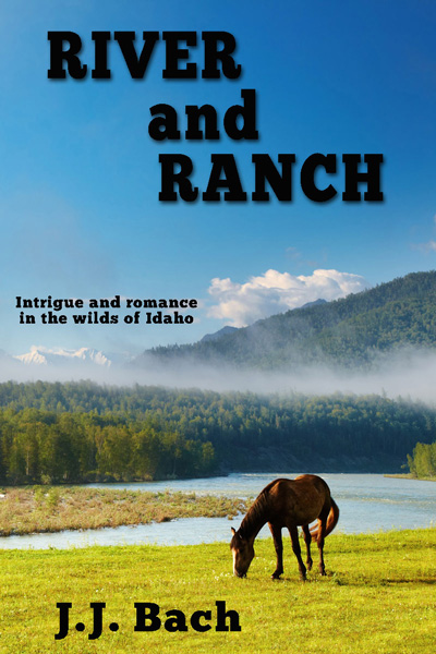
Summertime under a big blue Idaho sky. Four lives spinning together on river and ranch in the heart of flyover country. This is a novel on horseback with a woman riding the mountain trails of her ranching childhood. This is a novel in a raft, floating the remote Salmon river with a man trying to leave a past behind, looking for something better. It's a novel of wild places. It's a novel of family - coming home again!
Tuesday, October 25, 2016
A small spot in a quiet valley for a giant historic figure
Thursday, March 31, 2016
Rivers That Flow North
It's always a trivia question that no one ever gets. 'The Nile' is one rare answer. The question is 'Name a river that flows north?'.
Here are some more answers. River and Ranch is set in an area of the country that happens to feature not one, not two, but three river that rise in the south and FLOW to the north. Without further ado, here are three answers to that difficult trivia question.
1) The Lemhi river flows north. It rises near Gilmore Summit (elev. 7,150 ft amsl +/-) and flow generally north where it joins up with the Salmon River in the middle of Salmon, Idaho.
2) The Bitterroot river flows north. It rises in the small waters flowing out of the mountains in around and behind Lost Trail Pass. Trivially speaking everything on the Idaho side of that pass flows south and goes to the North Fork of the Salmon. But the snow that melts on the Montana side flows downhill to the NORTH and ultimately adds a load to the Bitterroot, which ultimately enters the Clark Fork (of the Columbia river - more trivia) in the valley just outside of Missoula, Montana.
Finally, the Big Mama of rivers that flow north - the Middle Fork of the Salmon.
3) Way down in central Idaho but quite high up there is Bear Valley creek, just outside of Stanley. It's a little thing flowing through meadows full of flowers. Once the snow melts. But while the snow is melting it is a big thing that combines with Marsh Creek and creates the Middle Fork. 100+ miles of north flowing beauty.
Wednesday, February 24, 2016
Road Trip turns up old TV reminder
Not quite what I was expecting to see in the middle of nowhere. So of course I stopped turned around and went back to look some more. Between kids, wife and my parents I've fallen into the trap of "just getting there". Once there we'd be stuck staring at hotel room walls or worse, boredom would set in. This trip I promised myself to remember the journey and NOT the destination. So I stopped all the time, drove slowly and looked at the small things. First off, I was amazed at how empty this stretch of road was. Once Idaho Falls was in the rear view mirror, I don't remember passing or being passed by any cars for hours and a good 150 miles. Midweek, midday, school in session. Quiet and empty. Flyover country.
Seeing this water tank and windmill was a great pullover. I wonder what ever happened to the old show? Someone must have the tapes. I wonder why reruns for this haven't happened. Beverly Hillbillies was the same time frame. I think.
At any rate, this is one more thing to pop into the book and a fun reminder of TV culture from way back in the day.
Monday, January 25, 2016
Book Research Surprise
The main point of this trip was to get back to one of my favorite places on the planet. Just for me. A reunion with place. Maybe some memories too. The second big reason was 'research' for River and Ranch. It did not disappointment. One of the big takeaways was the presence of Lewis and Clark. Lemhi Pass, Tendoy, North Fork, and the road up Agency Creek bore reminders that L & C had passed by way back in 1804-ish. Driving that road was an especially powerful reminder of what the Corps of Discovery accomplished. Agency Creek is possibly the steepest road I've ever driven up, especially the last pitch that tops out on the pass. It winds around for about thirteen miles, once you leave Tendoy. Doing this route while following a guide who had never 'quite' been there, with the beginning out of sight below you and the end unknown somewhere above you, like L&C did is a whole additional layer of difficulty. This is old land. It's been lived in for awhile now. Waves of people have washed over it. Seeing Lewis and Clark all over the place and experiencing the terrain they covered by foot without a road, while I did it in the comfort of car and trails made for compelling research and stands as a testimony to the strength and fitness that this group had hundreds of years ago, in conditions much more difficult than what we have now.
Tuesday, January 19, 2016
Leadore Idaho
Leaving Logan, Utah on the first day of my 'research trip' as I called it, I was quickly reminded of just how much more wide open, desolate, grayish space there is 'out west'. Leadore was the only big town outside of Salmon, once I left the Idaho Falls area. As you can see, it looks kind of like a ghost town. I drove some of the back streets and saw zero people outside. The entire town looked abandoned. It's not, at least according to what I read. In fact there's even a high school in this town, small as it is. Two hotels, four rooms each. One hotel owner is a wood carver of some repute, again according to what I read.
I billed this as a research trip for River and Ranch. Leadore was one of the 'must see' stops. Didn't know quite what to expect, but seeing zero people outside everywhere I went was a surprise. Maybe they only come out at night.....
Wednesday, January 13, 2016
Road Tripping in a Special Slice of Big Empty
Gilmore Summit is over 7,000 feet, why it's not a 'pass' I don't know, but if you're into big wide open spaces, it ranks well up there. I think the road image up top sums it up pretty well. I drove it midday, midweek, in late August - admittedly a quiet time, but still, once I left Idaho Falls and hit Hwy. 28, I think three cars passed me going the other way in over 100 miles. That's one of my indicators for being in big empty. I even bought a case of bottled water along with the last tank of gas in Terreton, the last town before things empty out. Just in case.
Like most other road trips through remote places, there's history along the way, the land for the most part, has already been lived in once or twice. Also like almost all other empty space, by definition, there are few, if any, people living in these places. Hwy. 28 followed this rule pretty well too. There were a few gravel roads that could have led to ranches I suppose, but I did not see any occupied houses, only shells of houses. Long empty, appealing in the sense of wondering who lived there and why would they choose such a desolate spot. These houses always seem to have the window casings removed, assuming they ever had windows with frames. Maybe that's another requirement for 'big empty', remaining houses must be scavenged for reuse elsewhere.
Anyway, I made it to Salmon, with Highway 28 turning out to be a wonderful prelude to small town places in the heart of flyover country. The reality of this place and space fits well with the feel I want the description of this road to have in River and Ranch.
Monday, January 11, 2016
Viola Anglin and the Tendoy General Store
It makes for quite a breadcrumb trail. First go to Idaho. Then go to Salmon. From Salmon go south-east out of town on Highway 28. You're now in the Lemhi River valley and you're going upstream. The country empties out real fast. You're heading towards the Gilmore Summit, elevation 7,186 feet. Be careful. Don't blink, or you'll miss Tendoy, it comes up fast as you zoom along old Highway 28. Tendoy's not really a town anymore. It's a wide spot. One of the neatest wide spots I've ever encountered, make that 'lucky enough to encounter'. There may not be any more spots like this left in the country.
Try and time your drive such that you arrive in Tendoy on a weekday during morning business hours. If you do that and you are lucky, having lived a good life, you'll find the Tendoy General Store to be open for business with Viola in charge of the counter. That's me and Viola in the picture at the top. Summer 2015. She was pushing 96 and that was summer of 2015. Still running a classic general store in Tendoy, Idaho. Viola is a rare piece of history. She is one of the few remaining people from this bygone era, much like WWII vets. Thankfully there are bits and pieces of Viola's story recorded for posterity, including this audio gem with Viola talking to Montana Public Radio about her life in Tendoy. Thank you for crossing the border MPR and spending time with this walking talking Idaho history book!
Discovering Viola Anglin remains my favorite piece, by far, of research for River and Ranch. This person, this bit of truth and reality, is every bit as interesting as anything I conjured up in the writing of River and Ranch. I feel fortunate to have met her.
Moscow-Pullman article on Viola and the Tendoy Store