The main point of this trip was to get back to one of my favorite places on the planet. Just for me. A reunion with place. Maybe some memories too. The second big reason was 'research' for River and Ranch. It did not disappointment. One of the big takeaways was the presence of Lewis and Clark. Lemhi Pass, Tendoy, North Fork, and the road up Agency Creek bore reminders that L & C had passed by way back in 1804-ish.


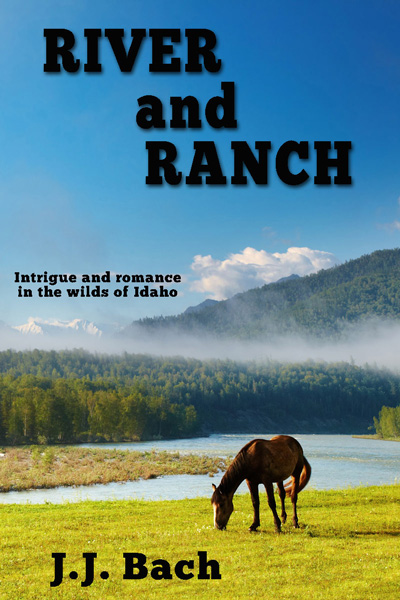
Summertime under a big blue Idaho sky. Four lives spinning together on river and ranch in the heart of flyover country. This is a novel on horseback with a woman riding the mountain trails of her ranching childhood. This is a novel in a raft, floating the remote Salmon river with a man trying to leave a past behind, looking for something better. It's a novel of wild places. It's a novel of family - coming home again!
Monday, January 25, 2016
Book Research Surprise

Tuesday, January 19, 2016
Leadore Idaho

Leaving Logan, Utah on the first day of my 'research trip' as I called it, I was quickly reminded of just how much more wide open, desolate, grayish space there is 'out west'. Leadore was the only big town outside of Salmon, once I left the Idaho Falls area. As you can see, it looks kind of like a ghost town. I drove some of the back streets and saw zero people outside. The entire town looked abandoned. It's not, at least according to what I read. In fact there's even a high school in this town, small as it is. Two hotels, four rooms each. One hotel owner is a wood carver of some repute, again according to what I read.
I billed this as a research trip for River and Ranch. Leadore was one of the 'must see' stops. Didn't know quite what to expect, but seeing zero people outside everywhere I went was a surprise. Maybe they only come out at night.....
Wednesday, January 13, 2016
Road Tripping in a Special Slice of Big Empty
 This is the 'lead in' to Salmon. My return started with a drive from Idaho Falls. Heading northwest, half is uphill to the crest at Gilmore Summit and then it's coasting all the way down the Lemhi river valley into Salmon. By the way, the Lemhi river is one of the few that flow north, the Middle Fork of the Salmon is another.
Gilmore Summit is over 7,000 feet, why it's not a 'pass' I don't know, but if you're into big wide open spaces, it ranks well up there. I think the road image up top sums it up pretty well. I drove it midday, midweek, in late August - admittedly a quiet time, but still, once I left Idaho Falls and hit Hwy. 28, I think three cars passed me going the other way in over 100 miles. That's one of my indicators for being in big empty. I even bought a case of bottled water along with the last tank of gas in Terreton, the last town before things empty out. Just in case.
Like most other road trips through remote places, there's history along the way, the land for the most part, has already been lived in once or twice. Also like almost all other empty space, by definition, there are few, if any, people living in these places. Hwy. 28 followed this rule pretty well too.
 There were a few gravel roads that could have led to ranches I suppose, but I did not see any occupied houses, only shells of houses. Long empty, appealing in the sense of wondering who lived there and why would they choose such a desolate spot. These houses always seem to have the window casings removed, assuming they ever had windows with frames. Maybe that's another requirement for 'big empty', remaining houses must be scavenged for reuse elsewhere.
Anyway, I made it to Salmon, with Highway 28 turning out to be a wonderful prelude to small town places in the heart of flyover country. The reality of this place and space fits well with the feel I want the description of this road to have in River and Ranch.
Monday, January 11, 2016
Viola Anglin and the Tendoy General Store

It makes for quite a breadcrumb trail. First go to Idaho. Then go to Salmon. From Salmon go south-east out of town on Highway 28. You're now in the Lemhi River valley and you're going upstream. The country empties out real fast. You're heading towards the Gilmore Summit, elevation 7,186 feet. Be careful. Don't blink, or you'll miss Tendoy, it comes up fast as you zoom along old Highway 28. Tendoy's not really a town anymore. It's a wide spot. One of the neatest wide spots I've ever encountered, make that 'lucky enough to encounter'. There may not be any more spots like this left in the country.
Try and time your drive such that you arrive in Tendoy on a weekday during morning business hours. If you do that and you are lucky, having lived a good life, you'll find the Tendoy General Store to be open for business with Viola in charge of the counter. That's me and Viola in the picture at the top. Summer 2015. She was pushing 96 and that was summer of 2015. Still running a classic general store in Tendoy, Idaho. Viola is a rare piece of history. She is one of the few remaining people from this bygone era, much like WWII vets. Thankfully there are bits and pieces of Viola's story recorded for posterity, including this audio gem with Viola talking to Montana Public Radio about her life in Tendoy. Thank you for crossing the border MPR and spending time with this walking talking Idaho history book!
Discovering Viola Anglin remains my favorite piece, by far, of research for River and Ranch. This person, this bit of truth and reality, is every bit as interesting as anything I conjured up in the writing of River and Ranch. I feel fortunate to have met her.
Moscow-Pullman article on Viola and the Tendoy Store
Monday, August 17, 2015
Fire Season in Idaho
Local Fire report
Thursday, April 30, 2015
Z is for Zoo
I know. I know, What a let down. Final day of the challenge and all I can do is come up with probably the plainest and most expected of all the "Z" words. There's zabra, which actually comes close to fitting my theme. There's zaffre, which also comes close to the theme. There's even a zarf, which I could have worked in.
For "Z" though, zoo fits best. The Vilas Zoo is one of the wonders of Madison. It's in the neighborhood where one of my River and Ranch and New Grass Growing MCs grew up. It's worthy of use in fictional world building, and it's also worthy of mention in reality.
The Henry Vilas Zoo sits on 50 acres of land donated by William and Ann Vilas in 1904. They specified that the 50 acres be used "for the uses and purposes of a public park and pleasure ground". The park was named in honor of the Vilas's son, Henry, who died at a young age from complications related to diabetes. The family stipulated that the park always be admission-free. It seems to me this is a charitable and magnificent way to honor the loss of their young son. He must have liked animals and running around outside, as most little kids do.
This ends April 2015. I'm sure May will bring plenty of surprises! Maybe even a few pleasures and likely even a few necessities.
Wednesday, April 29, 2015
Y is for Yankee Fork of the Salmon River
The Yankee Fork of the Salmon River meant I was getting close. Over the years of my life in Idaho as a guide on the Salmon, I remember driving by the Yankee Fork and never stopping. I remember feeling anxious to get to the guide shack in Salmon, so I always blew by the Yankee Fork. I remember an old broken remnant of a dam that the water was always piling up on and that's about it. Below is a great shot of the old Sunbeam Dam, courtesy of Osprey Packs
.

The dam was just upstream from the Yankee Fork. It was built to provide water for the mining operations on the Yankee Fork. The early history of area reads much like any other prospecting-based exploration of an unknown area. Eventually gold was discovered and mining began in earnest. That mining, especially in the WWII era, is a fascinating look at what humanity can do when it puts its mind to it. In 1939, the New York-based Silas Mason company was basically looking for gold. As fate would have it, they decided on a 5.5 mile stretch of the Yankee Fork as the site for their mining efforts. They then commissioned Bucyrus Erie to build a dredge in situ on the Yankee Fork, which when complete would provide the main means of mining that stretch of the Yankee Fork. Have a look at that dredge and how small everything else is around it. Tragically stupendous. Ultimately Simplot (see the first link top of the page) got left holding the bag. I'm unsure of their liability or how they came to assume it.
Wow. People can do the strangest things.